Devpost
Participate in our public hackathons
Devpost for Teams
Access your company's private hackathons
Grow your developer ecosystem and promote your platform
Drive innovation, collaboration, and retention within your organization
By use case
Blog
Insights into hackathon planning and participation
Customer stories
Inspiration from peers and other industry leaders
Planning guides
Best practices for planning online and in-person hackathons
Webinars & events
Upcoming events and on-demand recordings
Help desk
Common questions and support documentation
The qualitative effect of trees on improving pedestrian comfort
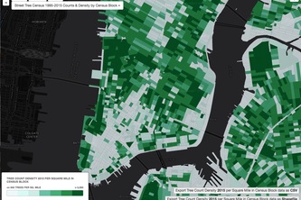
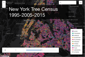
Map with dropdown to select tree counts by year...
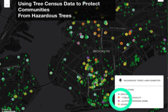
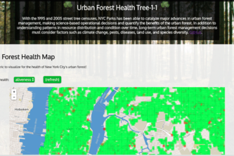
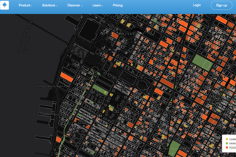
Website containing heatmaps and bar graphs visualizing tree health as it pertains to the local community.
Using average costs for different work orders we visualized 311 costs over time.
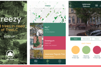
“Treezy” is a mobile app for matching users with nearby trees in most need.
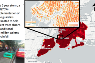
To estimate the citywide water absorption that could result from the complete implementation of tree guards
Question: Which genera increased or decreased in population over time, and which species grew the most.
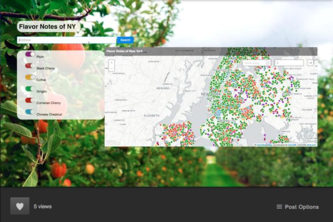
Mapping NYC's Urban Harvest
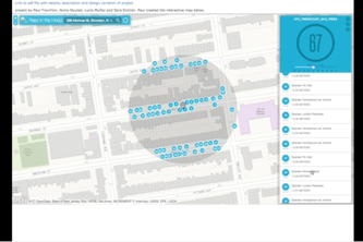
Tree-One-One is a web app that lets users explore different properties of trees within a given radius.
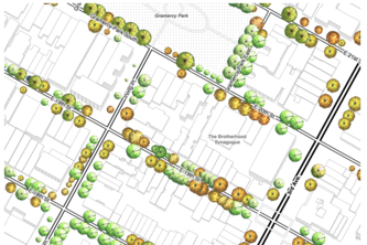
NYC street trees rendered dynamically in the landscape architecture hand-drawn tree plan view style.
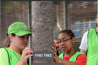
Helps locate a NYC tree using the location setting on someone’s smartphone
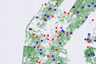
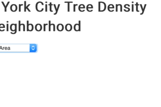
We provide citizens of NYC the ability to see the density of trees in their neighborhood
Engaging youth through games, information and a pet tree!
Measuring how street trees' impact on street life and quality
Map ash trees (genus Fraxinus) in New York City in preparation for emerald ash borer invasion.
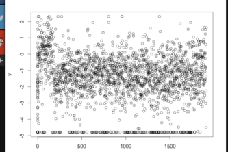
An overview of insights we learned from correlation analysis, with thoughts on further research.
A number of maps and dashboards that explore the tree census data
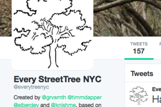
EveryTreeNYC is a Twitter bot that showcases the personality of NYC street trees
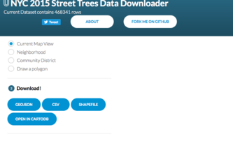
This is a simple data downloader for the 2015 Street Trees Data
Create dynamic site & Tree signage for exploration, education, connection w/trees & promote stewardship.
We are connecting tree data with civic engagement, based on election turnout and 311 calls
1 – 21 of 21